
教育背景
2002.9~2006.6,武漢大學,資源環境與城鄉規劃管理,理學學士。
2006.9~2008.3,荷蘭ITC,地理信息科學與遙感套用,碩士(MSc),導師:Mannaerts, C.M.博士。
2006.9~2008.6,武漢大學,土地資源管理,管理學碩士,導師:劉艷芳教授 。
2008.9~2011.6,武漢大學,土地資源管理,管理學博士,導師:劉耀林教授。
研究經歷:
2011.9~2013.8,武漢大學,地理學博士後流動站,師資博士後,合作導師:林愛文教授。
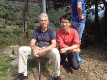 陳奕雲-劍橋訪問期間
2014.7~2015.1,劍橋大學,地理系,訪問學者,合作導師:Bob Haining教授。
2014.1~至今 ,武漢大學蘇州研究院,項目研究員。
研究領域:
土壤高光譜遙感;空間數據分析;
承擔項目與課題:
1. 中國博士後科學基金面上資助(一等資助):濱湖農田土壤有機碳的光譜回響特徵及機理分析
2. 國家自然科學基金青年基金:顧及環境變數和樣本空間依賴的濱湖農田土壤有機碳近地高光譜建模策略研究(項目批准號41501444 ,2016-2018)
學術論文(代表性成果):
2015年:
[1] Y. Liu, L. Guo, Q. Jiang, H. Zhang, Y. Chen*, 2015. Comparing geospatial techniques to predict SOC stocks. Soil and Tillage Research. 148, 46-58.
[2] T. Shi, Y. Chen, Y. Liu, G. Wu, 2014. Response to “Visible and near-infrared reflectance spectroscopyis of limited practical use to monitor soil contamination by heavy metals” by Philippe C. Baveye. Journal of Hazardous Materials. 285(0), 207.
[3] 陳奕雲, 漆錕, 劉耀林, 何建華, 姜慶虎, 2015. 顧及土壤濕度的土壤有機質高光譜預測模型傳遞研究. 光譜學與光譜分析.35(6), 1705-1708.
2014年:
[1] Y. Liu, Q. Jiang, T. Fei, J. Wang, T. Shi, K. Guo, X. Li, Y. Chen*, 2014. Transferability of a Visible and Near-Infrared Model for Soil Organic Matter Estimation in Riparian Landscapes. Remote Sensing. 6(5), 4305-4322.
[2] Y. Liu, Q. Jiang, T. Shi, T. Fei, J. Wang, G. Liu, Y. Chen*, 2014. Prediction of total nitrogen in cropland soil at different levels of soil moisture with Vis/NIR spectroscopy. Acta Agriculturae Scandinavica, Section B–Soil & Plant Science 64(3), 267-281. (Published: 16 Apr 2014)
[3] T. Shi, Y. Chen, H. Liu, J. Wang, G. Wu, 2014. Soil Organic Carbon Content Estimation with Laboratory-Based Visible-Near-Infrared Reflectance Spectroscopy: Feature Selection. Applied Spectroscopy. 68(8), 831-837.
[4] T. Shi, Y. Chen, Y. Liu, G. Wu, 2014. Visible and near-infrared reflectance spectroscopy—An alternative for monitoring soil contamination by heavy metals. Journal of Hazardous Materials. 265(0), 166-176.
[5] J. Wang, L. Cui, W. Gao, T. Shi, Y. Chen, Y. Gao, 2014. Prediction of low heavy metal concentrations in agricultural soils using visible and near-infrared reflectance spectroscopy. Geoderma. 216(0), 1-9.
[6] X. Peng, T. Shi, A. Song, Y. Chen, W. Gao, 2014. Estimating Soil Organic Carbon Using VIS/NIR Spectroscopy with SVMR and SPA Methods. Remote Sensing. 6(4), 2699-2717.
[7] T. Shi, H. Liu, J. Wang, Y. Chen, T. Fei, G. Wu, 2014. Monitoring Arsenic Contamination in Agricultural Soils with Reflectance Spectroscopy of Rice Plants. Environmental Science & Technology. 48(11), 6264-6272. (SCI 1區)
[8] K. Guo, Y. Liu, C. Zeng, Y. Chen, X. Wei, 2014. Global research on soil contamination from 1999 to 2012: A bibliometric analysis. Acta Agriculturae Scandinavica, Section B–Soil & Plant Science. 64(5), 377-391.
[9] Y. Gao, L. Cui, B. Lei, Y. Zhai, T. Shi, J. Wang, Y. Chen, H. He, G. Wu, 2014. Estimating soil organic carbon content with visible/near-infrared (Vis/NIR) spectroscopy. Applied Spectroscopy. 68(7), 712-722.
[10] 劉艷芳, 方佳琳, 陳曉慧, 陳奕雲*, 2014. 基於確定性係數分析方法的秭歸縣滑坡易發性評價. 自然災害學報. 23(6), 209-217.
[11] 盧延年, 劉艷芳, 陳奕雲, 姜慶虎, 2014. 江漢平原土壤有機碳含量高光譜預測模型優選, 中國農學通報, 30(26), 127-133.
2013年:
[1] X. Kong, Y. Liu, X. Liu, Y. Chen, D. Liu, 2013. Thematic maps for land consolidation planning in Hubei Province, China. Journal of Maps(ahead-of-print), 1-9.
[2] Y. Liu, X. Kong, Y. Liu, Y. Chen, 2013. Simulating the Conversion of Rural Settlements to Town Land Based on Multi-Agent Systems and Cellular Automata. PloS one. 8(11), e79300.
[3] T. Shi, L. Cui, J. Wang, T. Fei, Y. Chen, G. Wu, 2013. Comparison of multivariate methods for estimating soil total nitrogen with visible/near-infrared spectroscopy. Plant and soil. 366(1-2), 363-375. (SCI 1區)
[4] 嚴金明, 張楊, 江平, 陳奕雲, 2013. 論國土生態文明戰略框架設計, 新疆師範大學學報(哲學社會科學版), 34(6), 25-31.
2012年:
[1] Y. Chen, Y. Liu, Y. Liu, A. Lin, X. Kong, D. Liu, X. Li, Y. Zhang, Y. Gao, D. Wang, 2012. Mapping of Cu and Pb Contaminations in Soil Using Combined Geochemistry, Topography, and Remote Sensing: A Case Study in the Le’an River Floodplain, China. International Journal of Environmental Research and Public Health. 9(5), 1874-1886. (2012 IF=1.998)
[2] Y. Liu, Y. Chen*, 2012a. Estimation of total iron content in floodplain soils using VNIR spectroscopy – a case study in the Le'an River floodplain, China. International Journal of Remote Sensing. 33(18), 5954-5972. (2012 IF=1.138)
[3] Y. Liu, Y. Chen*, 2012b. Feasibility of Estimating Cu Contamination in Floodplain Soils using VNIR Spectroscopy—A Case Study in the Le’an River Floodplain, China. Soil and Sediment Contamination: An International Journal. 21(8), 951-969. (2012 IF=0.509)
[4] Y. Liu, D. Liu, Y. Liu, J. He, L. Jiao, Y. Chen, X. Hong, 2012. Rural land use spatial allocation in the semiarid loess hilly area in China: Using a Particle Swarm Optimization model equipped with multi-objective optimization techniques. Science China Earth Sciences. 55(7), 1166-1177.
[5] Y. Zhang, Y. Chen, Q. Ding, P. Jiang, 2012. Study on Urban Heat Island Effect Based on Normalized Difference Vegetated Index: A Case Study of Wuhan City. Procedia Environmental Sciences. 13, 574-581.
[6] X. Zhao, Y. Liu, X. Ma, Y. Chen, 2012. A knowledge-based approach for assessing the quality of Landsat water body mapping product. International Symposium on Geomatics for Integrated Water Resources Management (GIWRM), 2012 (1-5).
2010年:
[1] X. Kong, Y. Liu, Y. Zou, Y. Chen, 2010. Calculation of land consolidation potential and optimization of rural residential areas based on households' willingness. Transactions of the Chinese Society of Agricultural Engineering. 26(8), 296-301.
[2] X. Kong, Y. Liu, Y. Zou, Y. Chen, 2010. Potential Supply of Cultivated Land under the Land Consolidation of Rural Residential Areas Based on GIS.International Conference on Internet Technology and Applications, 2010 (1-4).
2009年:
[1] Y. Chen, Y. Liu, D. Wang, X. Kong, C. Zeng, 2009. Feasibility of estimating heavy metal concentrations in water column using hyperspectral data and partial least squares regression. International Symposium on Spatial Analysis, Spatial-Temporal Data Modeling, and Data Mining. Wuhan, China.
獎勵與榮譽
2014中國地理信息科技進步獎一等獎:智慧型空間最佳化關鍵技術與套用,排名第8(中國地理信息產業協會)。
中國土壤學會土壤遙感與信息專業委員會2013年學術研討會優秀論文一等獎:盧有賡等,濱湖農田土壤全氮含量可見/近紅外光譜反演模型,本人為指導老師,通訊作者。
中國土壤學會土壤遙感與信息專業委員會2013年學術研討會優秀論文二等獎:柳登科等,礦區土壤硫的高光譜遙感反演方法初探,本人為指導老師,通訊作者。
2013年湖北省優秀學士學位論文《基於可見—近紅外反射光譜指數的土壤有機碳含量反演》(作者:林懿瓊)指導老師。
2011年度高等學校科學研究優秀成果獎(科學技術):全數字、多用途土地資源評價關鍵技術與套用(科技進步獎:二等獎)排名第10 (2011-11-30)(教育部)。
